

Name: Republic of South Africa
Capital: Pretoria (Executive); Cape Town (Legislative) and Bloemfontein (Judicial)
Currency: Rand
Religion: Christianity, Hinduism and Islam
Population: 43 million
Official languages: 11 including English, Afrikaans and 9 other native African languages
Agricultural products: corn, wheat, sugarcane, vegetables, beef, poultry, mutton, fleece, and dairy products
Key sectors: mining industry (South Africa is the number one producer of platinum, gold and chromium); automobile assembly, metallurgy, machinery, textile, steel production, chemical production, fertilizer and food
Natural resources: gold (number one in the world), diamonds (number two in the world), platinum, uranium (number three in the world), coal, iron ore, phosphate, manganese and seafood (number six in the world)
Primary exports: gold, minerals, food, and chemical products
Primary imports: machinery, transportation equipment, chemicals, petroleum products, textile, high-tech products

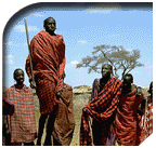
South Africa aptly describes the notion of "seeing the whole world by traveling to a single nation". South Africa boasts rich and diversified cultures, technological advancement, extensive collection of wildlife, thorough urban/rural planning, high-quality
road constructions, fresh air and enthusiastic hospitality from the local citizens. Coupled with substantially more investment opportunities compared to European countries and U.S., South Africa has drawn millions of tourists and entrepreneurs from around the world who wish to learn more about the nation.
Results of the census conducted in 2000 indicated that South Africa's total population came to approximately 43 million people; 77% Black African, 11% White, 9% Colored (or "Mixed") and 3% Asians and Indians. The nation's population density came to 92/mi2 and the largest urban area of South Africa is the Cape Peninsula with 2.35 million people, followed by Johannesburg (1.92 million), East Rand (1.38 million), Durban (1.14 million) and Pretoria (1.08 million).
 Two thirds out of the South African population belong to the Nguni ethnicity, including the Sotho-Tswana from Basotho, Bapedi and Tswana, the Shangaan, the Venda, the Afrikaners (early immigrants from Dutch), the Anglo-Africans, the mixed, the Indians and other African / European
and Asian ethnicity, who still faithfully preserved their cultural traditions. There is also a small group of Khoe tribe and San tribe descendants. According to the census, the five most prevalent languages spoken in Sough Africa are IsiZulu (22.9%), IsiXhosa (17.9%), Afrikaans (14.4%), Sepedi (9.2%) and English (8.6%).

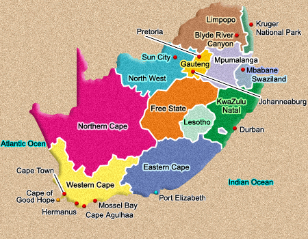
The Republic of South Africa is located at the southernmost tip of the African continent, with latitude and longitude spanning from 22° to 35° and 17° to 33° respectively. The country occupies an area of 1,219,912 km2 (471,440 mi2) and her neighboring countries include Namibia, Botswana, Zimbabwe, Mozambique, Swaziland while the Kingdom of Lesotho is entirely surrounded by the territory of South Africa at the southeast portion. South Africa is surrounded by the Atlantic Ocean on her west coast and the Indian Ocean on her east and south coasts. The archipelago of Prince Edward Island and Marion Island, located 1920 km away to the southeast of Cape Town in the Atlantic Ocean, was included into South Africa's territory in 1947.

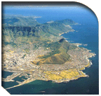
The Republic of South Africa is surrounded by oceans on three sides (east, south and west) and has a long coastal line. Two currents flow in the bodies of water surrounding South Africa: the "Mozambique Agulhas current" is a South Equatorial Current that runs from the east coast
of South Africa all the way towards Cape Agulhas to the south coast; and the "Benguela current", a cold current that runs from the west coast of South Africa and extends to the north till southern Angola. The difference in temperature between the two currents is one of the primary factors that leads to the difference in climate and vegetation between South Africa's east and west. Not only that, the mixture of the two currents also results in rich ecodiversity of marine lifeforms. The waters of the west coast are cold and richer in oxygen, nitrate fertilizer and phosphate compared to that of the east coast. This explains why South Africa's fishing industry is primarily concentrated along the west coast.

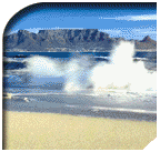
The coastal lines of South Africa are evenly enclosed with several jagged shores that are suitable for port construction. Running over a total distance of 3000 kilometers, the only natural bay along South Africa's coastal line is the Saldanha Bay on her west coast.
However, the region suffers from water shortage and it is not sufficient to serve as a barrier for the inland area. Most of the estuaries in South Africa are not suitable for harbor construction because of numerous formations of large sandbars over the years. These sandbars are formed from periodic sediments brought by waves, the tides, along with steep running streams in South Africa. Only major rivers such as the Orange River and Limpopo River are able to make it through the sandbars due to their strong currents. Typically speaking, rivers in South Africa are not fit for navigation.

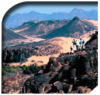
The topology of South Africa can basically be broken down into three types of landforms: interior plateaus, escarpments extending from the inland plateaus towards the coastal lines and the fall lines, which define the areas between these two types of landforms. Fall lines are the
most prevalent and continuous type of landform in South Africa. Elevation of fall lines in South Africa varies according to the area - from 1500 meters above sea level at the basalt-covered Roggeveld Mountains to 3482 meters above sea level at the Drakensberg of KwaZulu-Natal Province. The inland escarpment of the South African plateau is the southward extension of the Great African Plateau that stretches towards the Sahara desert in the north.
The defining characteristics of typical African plateaus are vast, open plains at an elevation of approximately 1200 meters. Crossing the plateau region of Africa, one would come to the mountainous range of South Africa shaped by distinctive contours, with the Kingdom of Lesotho as the representative landform. In the middle of the continental fall lines and the coastal lines of South Africa lie two escarpments in the southeast (with a width varying from 80 to 240km) and the west (with a width of 60-80km). There are at least three stretches that are easily recognizable: the escarpment at the eastern plateau, the region around Constantia Valley and the escarpment at the western plateau.


South Africa is situated along a high-pressure, subtropical belt at 30° latitude. The country enjoys a temperate climate that is dry with ample sunshine. In addition, her geographical conditions (with three sides surrounded by oceans) also contribute specific influences
to her climate, with the warm Agulhas current along the east coast and cold Benguela current along the west coast being the most significant. To illustrate the significance of these currents' influence on the climate, although the city of Durban, along the east coast, and Port Nolloth, along the west coast, are fairly close in terms of latitude, the difference between their average annual temperatures could reach as high as six degrees centigrade. Strong seasonal winds are frequent occurrences along the coastal lines of South Africa, specifically along the southwestern and south coasts.

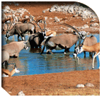
The average annual rainfall South Africa is around 464mm, far lower compared to the average annual rainfall around the world at 857mm. In fact, 21% of South Africa's total land area receives less than 200mm of precipitation a year, while 48% gets somewhere between
200mm and 600mm of rainfall. Only about 30% of South Africa's land area sees annual precipitation over 600mm. As a result, as high as 65% of South Africa's land area receives less than 500mm of rainfall in a given year. Such limited amount of rainfall is barely sufficient for the local dry land agricultural industries. At Cape Town, the winter season from May to July is the period of most abundant rainfall, while the rainy seasons for other provinces usually occur in the summer from November to January. Most of the precipitation come in the form of cool, mist-clearing thundershowers. It is difficult to predict the amount of rainfall in South Africa because many areas receive drastically different amount of precipitation, and most changes in the amount of precipitation tend to be descending differences rather than ascending. South Africa suffers from occasional threats of draught that often end in floods, which serve as typical examples of varying precipitation.


There are three specific traits that characterize the temperature of South Africa:
1. It is lower compared to Australia despite the fact that both countries are situated at the same latitude. This is because the elevation in South Africa is higher.
2. Although the difference in latitude from the southernmost point to the northernmost tip of South Africa is as large as 13°, the average temperatures at different regions across the entire nation are fairly identical. This is due to the fact that the elevation in South Africa steadily rises as one moves northeast from the south, which mitigates the differences in temperature. And
3. The gap in temperatures between the east and west coast of South Africa could get fairly large. As we have seen earlier, this is caused by the warm and cold currents flowing along the east and west coasts respectively. It is not unusual for South Africa summers to reach 32 degrees centigrade. In fact, it could easily get hotter than 38 degrees centigrade at Orange River Valley and the lowlands of Mpumalanga. In contrast, due to relatively lower humidity and higher latitude, the northern provinces in South Africa enjoy lower temperature and milder climate.


South Africa is renowned for her ample sunshine. Typically speaking, the mild sunshine during April and May in early winter makes it extremely pleasant to be outdoors. At this time of the year, the rainy season in areas with the most precipitation during summer has ended
and it has yet to begin at areas with most rainfall during the winter. On the other hand, the heat of the summer would have dissipated by this time and the seasonal winds tend to be gentler compared to other months. However, the harsh winter period during June and July is usually the best time to visit specific regions such as the coastal area of Kwazulu/Natal Province, Mpumalanga and Northern Province where the climate is hot and humid.

©2009 Rock Sun Travel. All Rights Reserved.
This website is best viewed at a resolution of 800*600 with
Internet Explorer 5.0 or higher.
 Links:South African Tourism | Rovos Rail | Sun City Hotel | Blue Train
Contact Us 2012 Rock Sun Travel.All Rights Reserved.


